Log in
All resources
Create a design
40,209 Free Images of Engraved Maps
1552
geographiae claudii ptolemaei alexandrini (münster
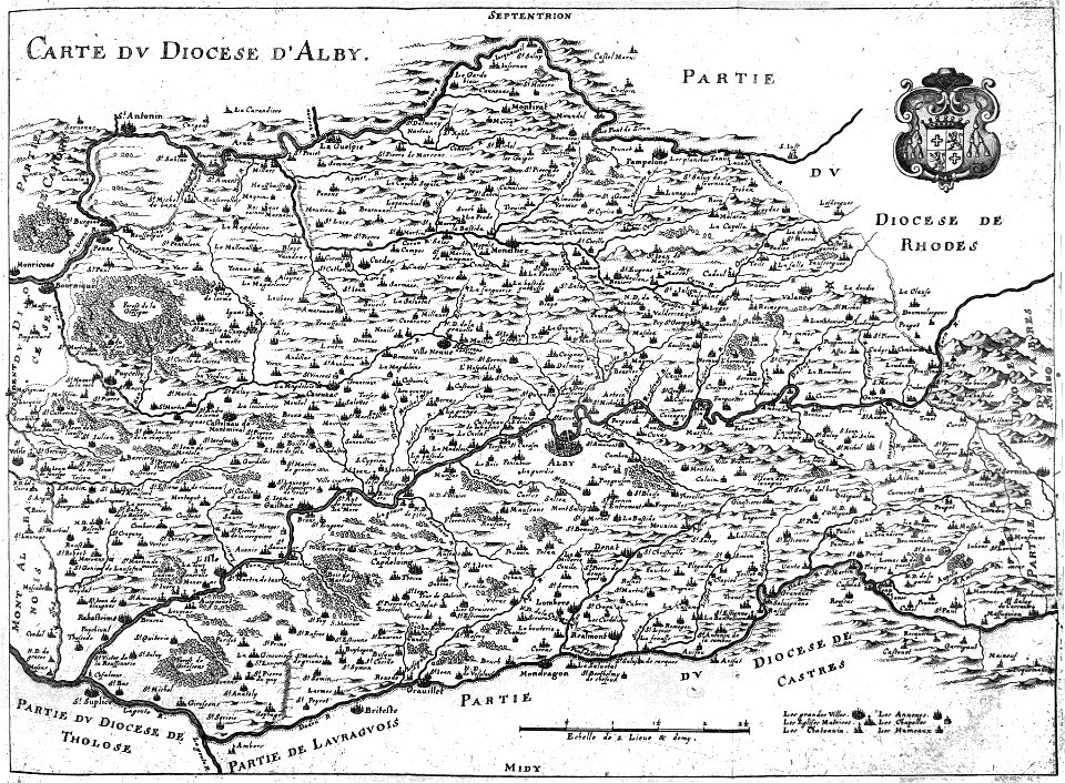
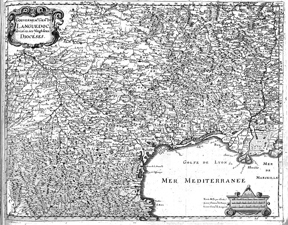
bibliothèque municipale de reims
rès. g 153
maps of the dutch east india company - sri lanka
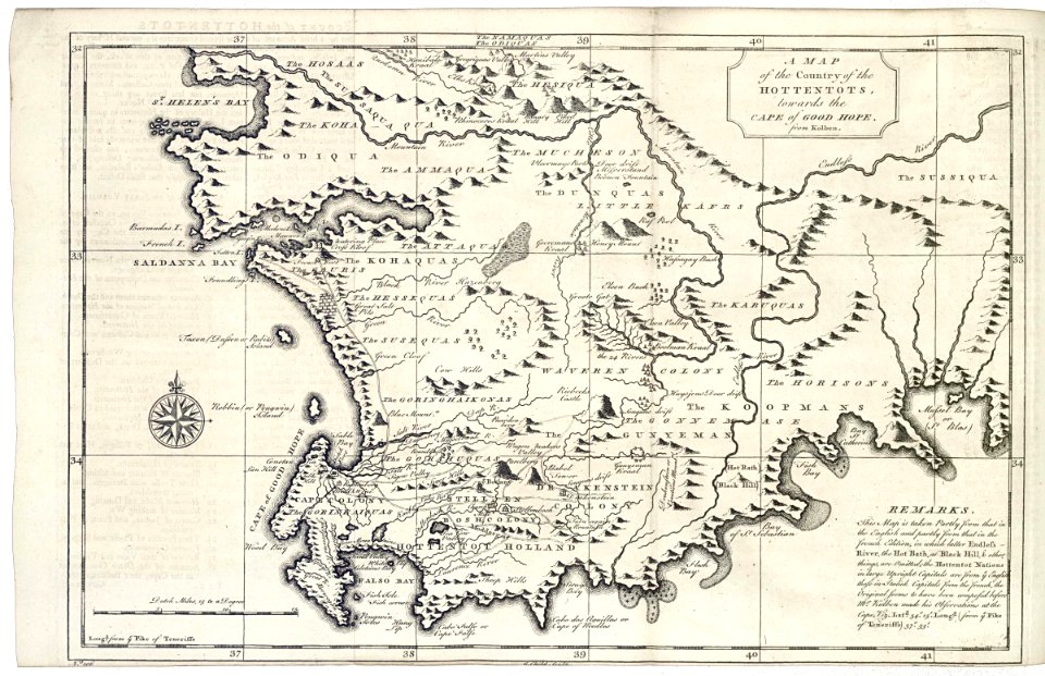
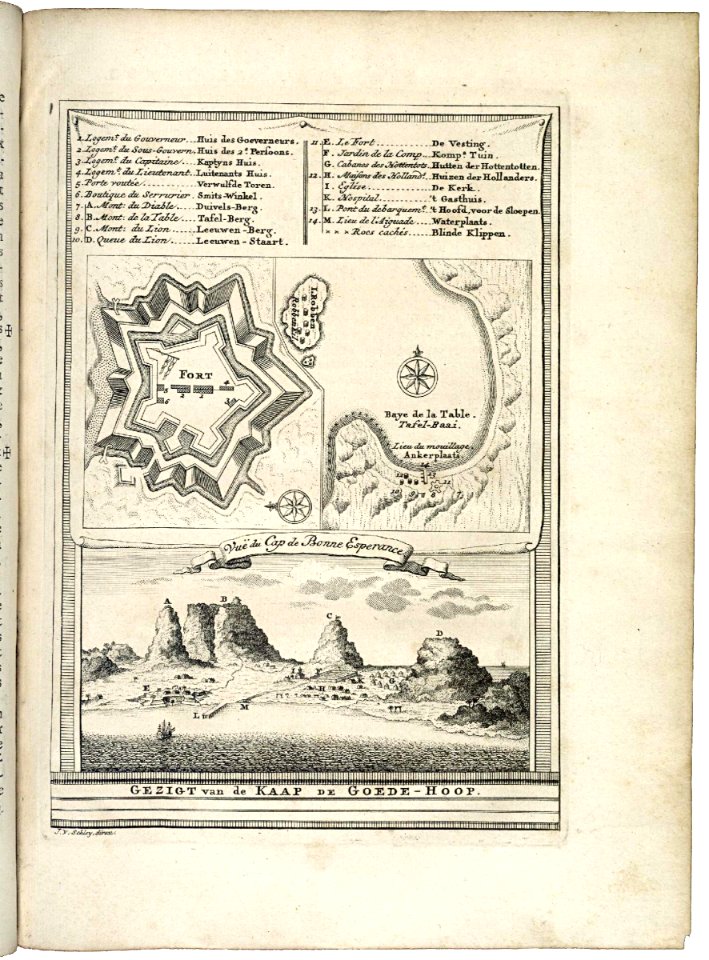
maps of the dutch east india company - south africa
atlas beudeker
geographical illustrations by coronelli
charts and maps of the royal museums greenwich
atlante veneto (raremaps.com) volume 1
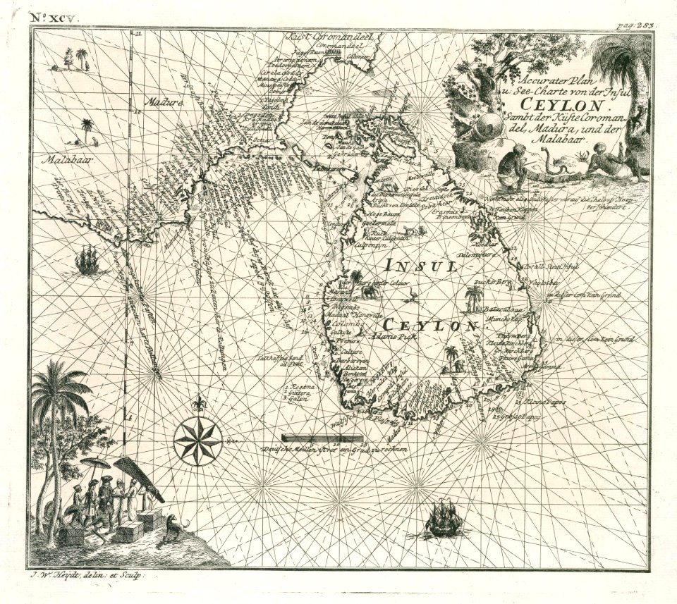
maps of the dutch east india company - sri lanka
1730s
maps of the dutch east india company - south africa
1726
maps of the dutch east india company - sri lanka
1730s
maps of the dutch east india company - sri lanka
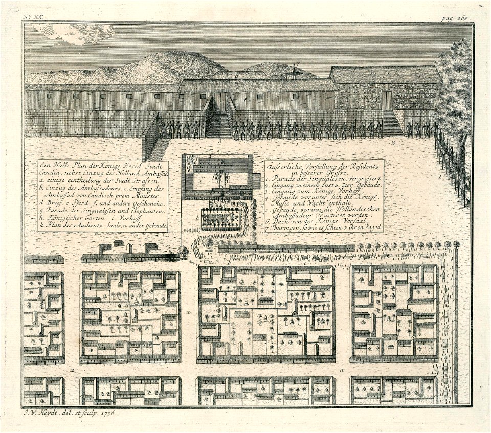
1736
maps of the dutch east india company - sri lanka
1730s
maps of the dutch east india company - sri lanka
1726
maps of the dutch east india company - south africa
1726
maps of the dutch east india company - south africa
1745
maps of the dutch east india company - south africa
1747)
maps of the dutch east india company - st helena
1749
maps of the dutch east india company - sri lanka
1753
old maps of the dutch east india company - africa
1747)
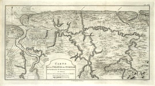
maps of the west-indische compagnie
1773
maps of the west-indische compagnie
1773
maps of the dutch east india company - south africa
1753
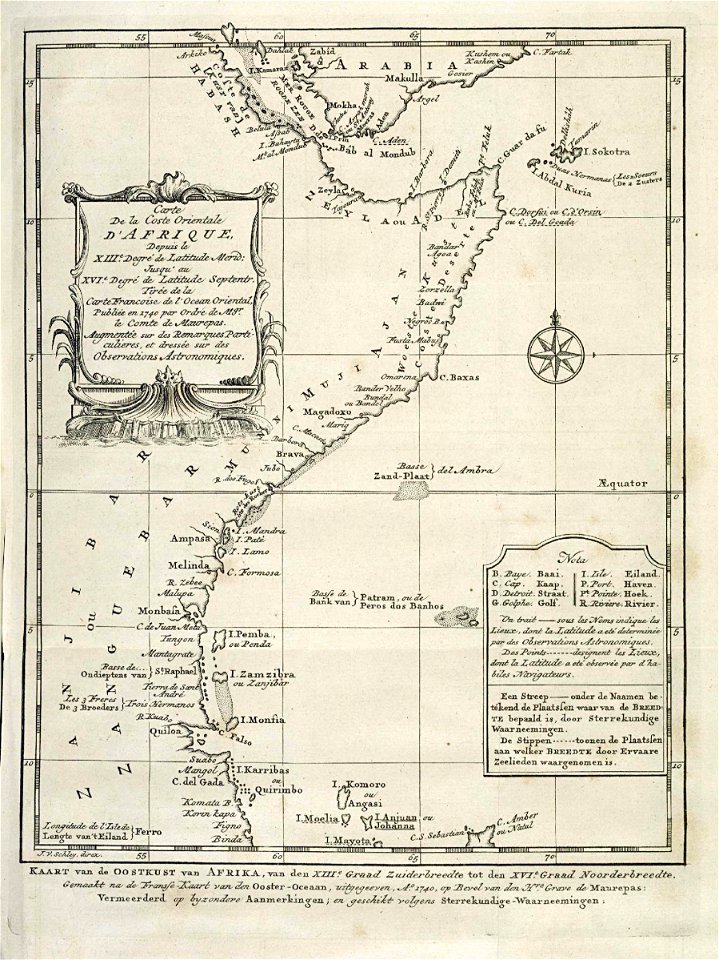
maps of the dutch east india company - india
1755
maps of the dutch east india company - south africa
1747)
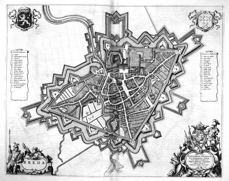
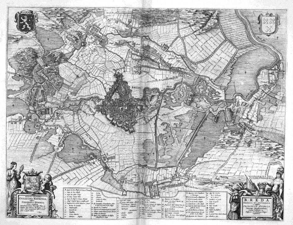
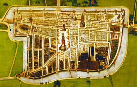
old maps of breda
atlas beudeker
old maps of breda
atlas beudeker
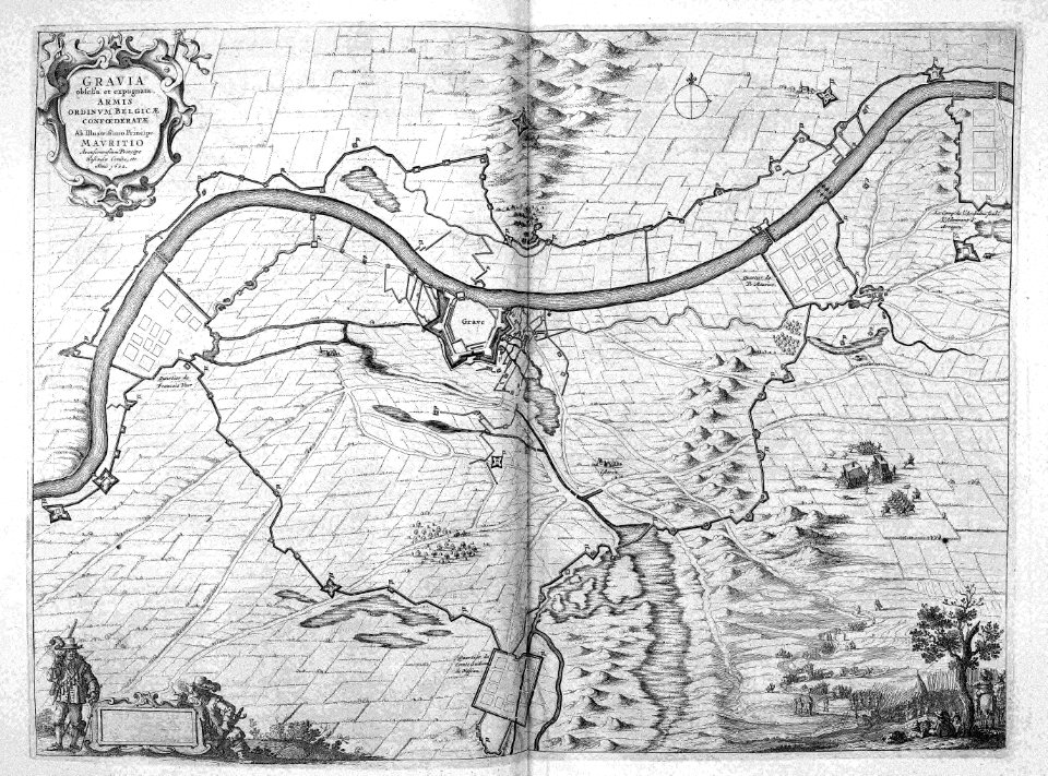
siege of grave 1602
netherlands
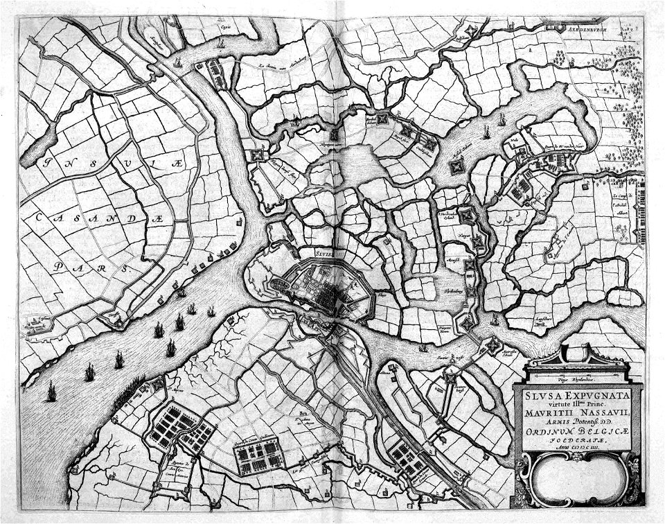
siege of sluis 1604
atlas beudeker
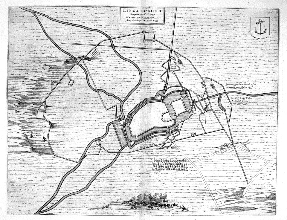
maps of lingen (ems)
atlas beudeker
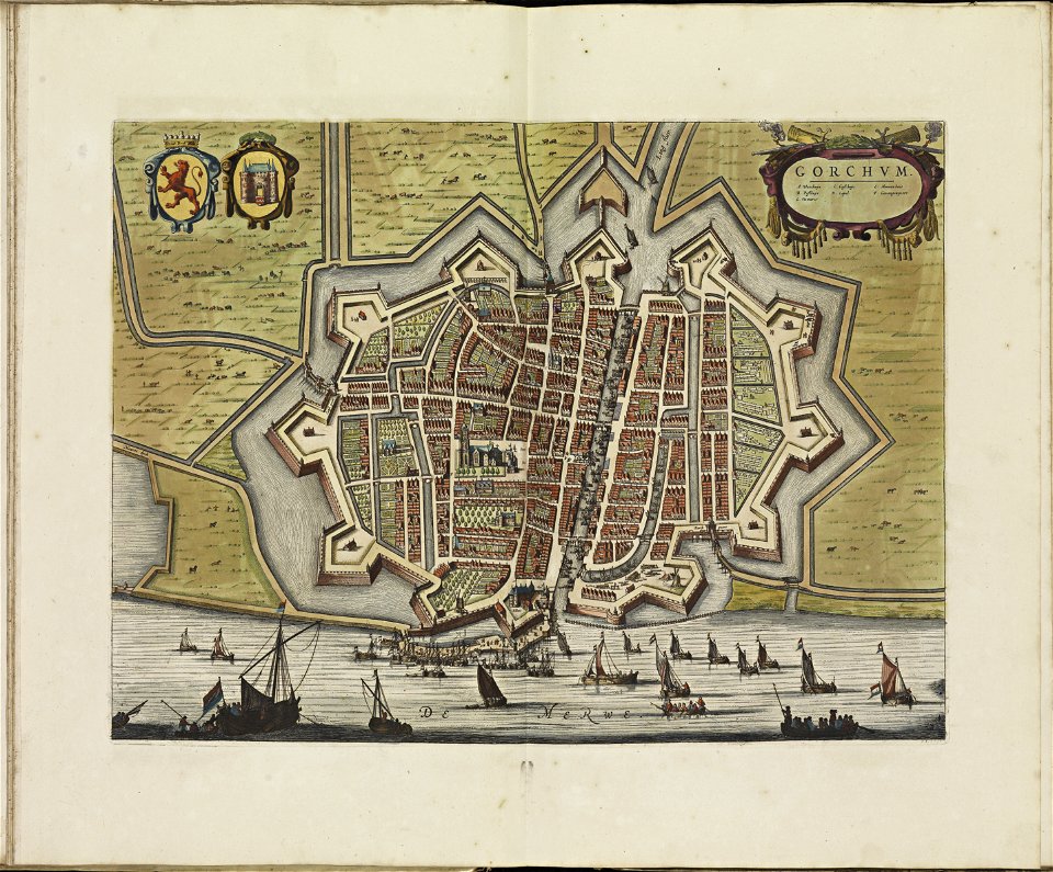
old maps of gorinchem
atlas de wit 1698
copper engravings in the universitätsbibliothek salzburg
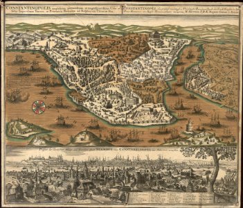
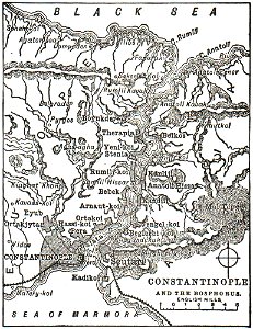
old maps of istanbul
liber insularum archipelagi (royal museums greenwich)
old maps of constantinople
charts and maps of the royal museums greenwich
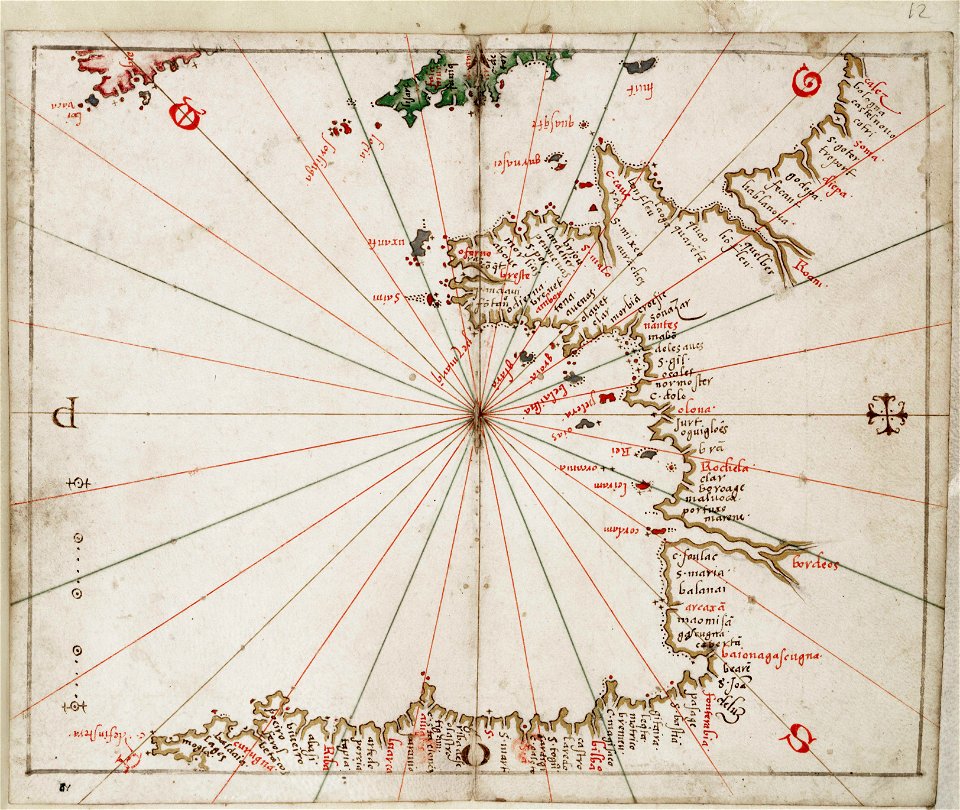
joan martines
jan huygen van linschoten
1596 maps of asia
atlante veneto (raremaps.com) volume 1
old maps of the danube
atlante veneto (raremaps.com) volume 1
old maps of north america
atlante veneto (raremaps.com) volume 1
old maps of south america
atlante veneto (raremaps.com) volume 1
old maps of the americas
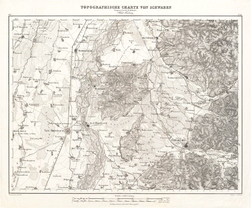
charte von schwaben (bohnenberger)
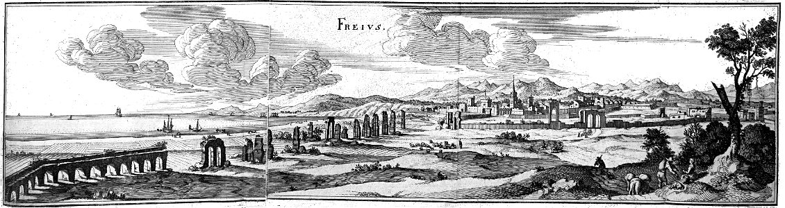
old maps of freiburg im breisgau
geographical illustrations by coronelli
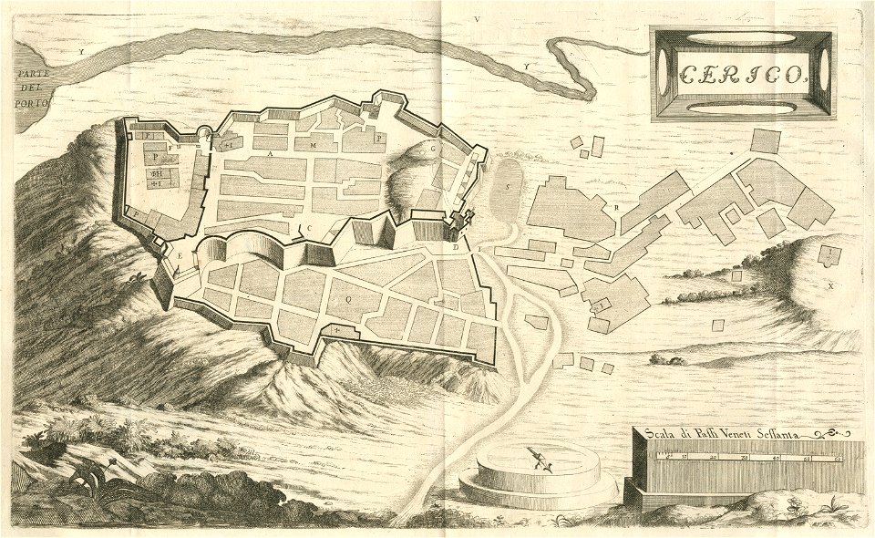
engravings of kythira
bibliothèque municipale de reims
rès. g 153
bibliothèque municipale de reims
rès. g 153
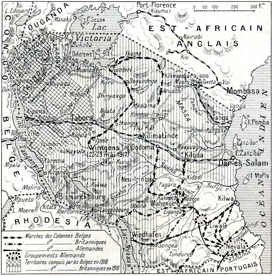
african theatre maps of world war i
no 3908 illustrations
bibliothèque municipale de reims
rès. g 153
old maps of bohemia
1552
old maps of transylvania
1552
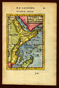
1550s maps of africa
1552
old maps of france
1552
old maps of scandinavia
1552
geographiae claudii ptolemaei alexandrini (münster
1552
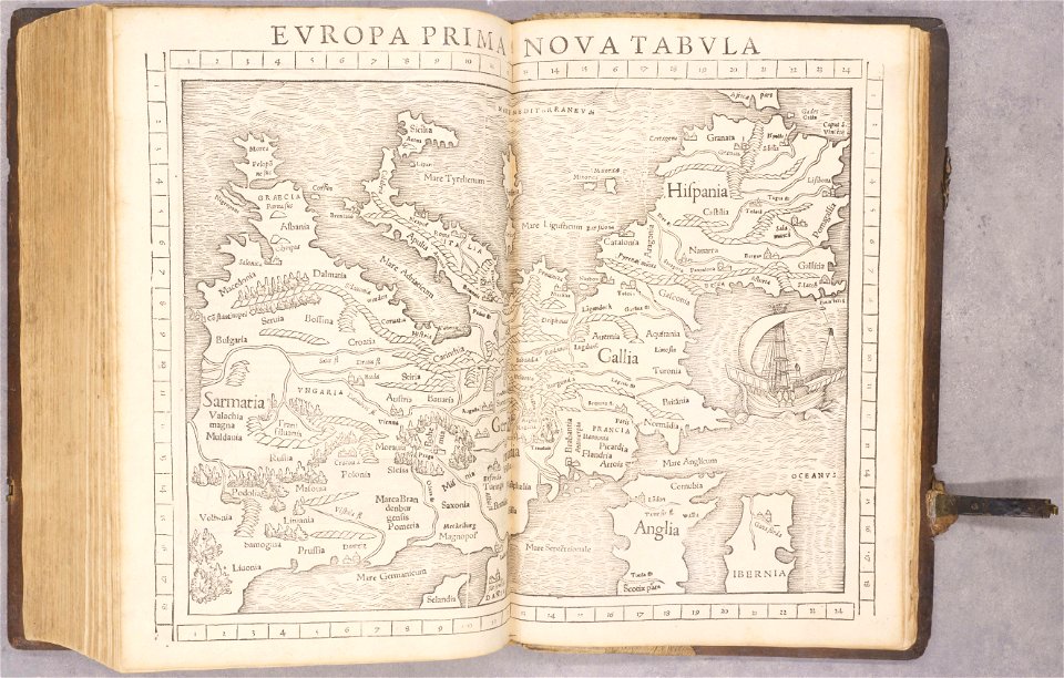
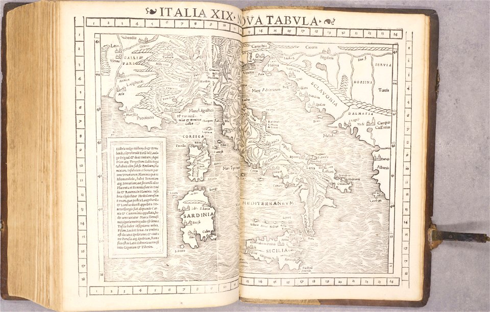
old maps of italy
1552
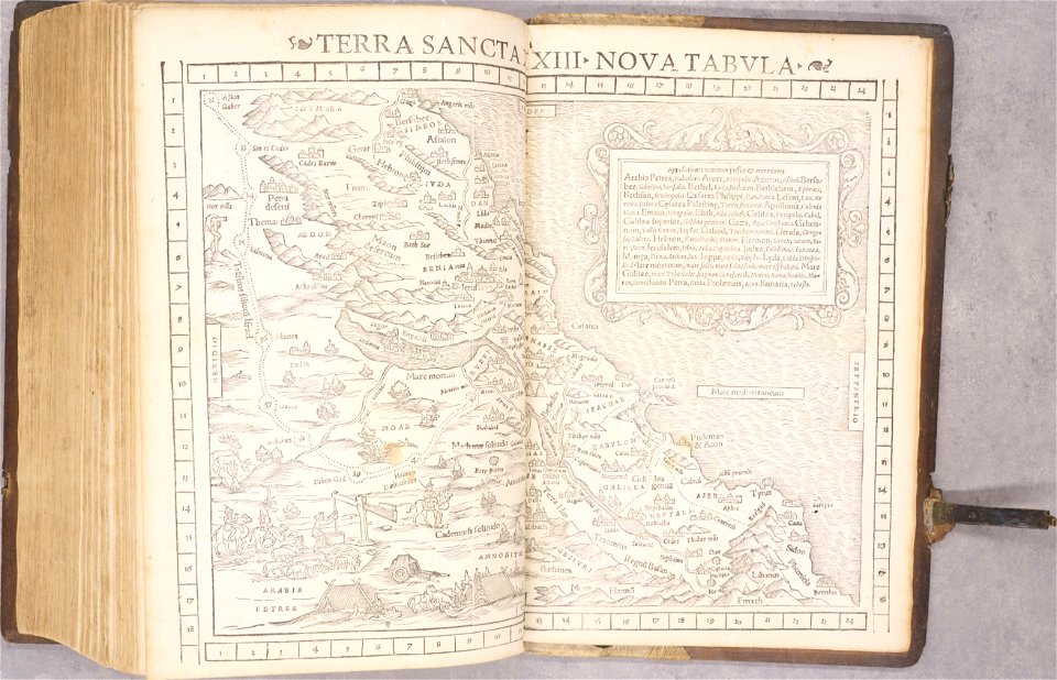
old maps of palestine
1552
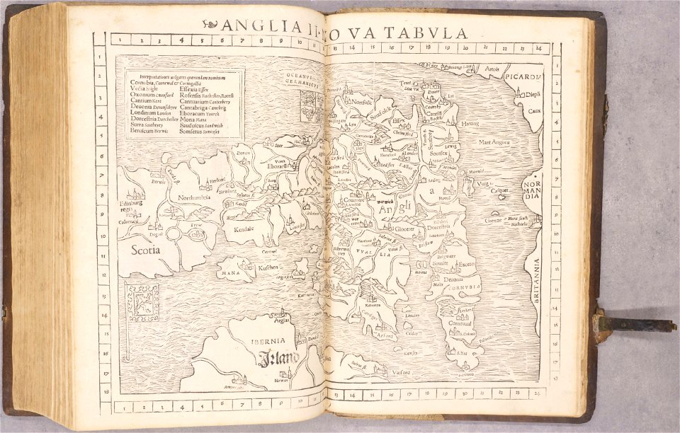
old maps of england
1552
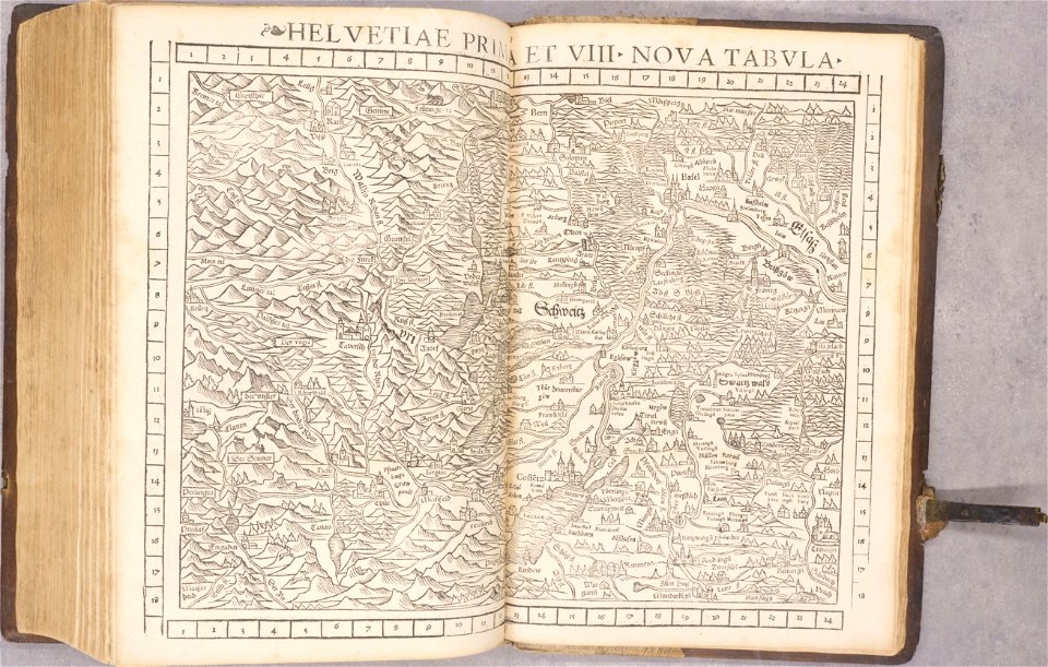
old maps of switzerland
1552
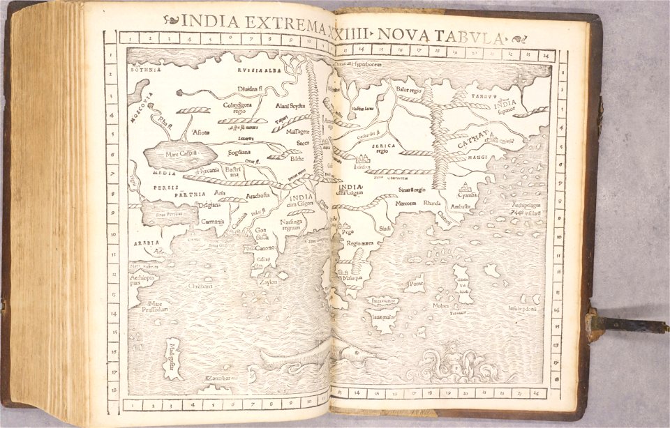
old maps of asia
1552
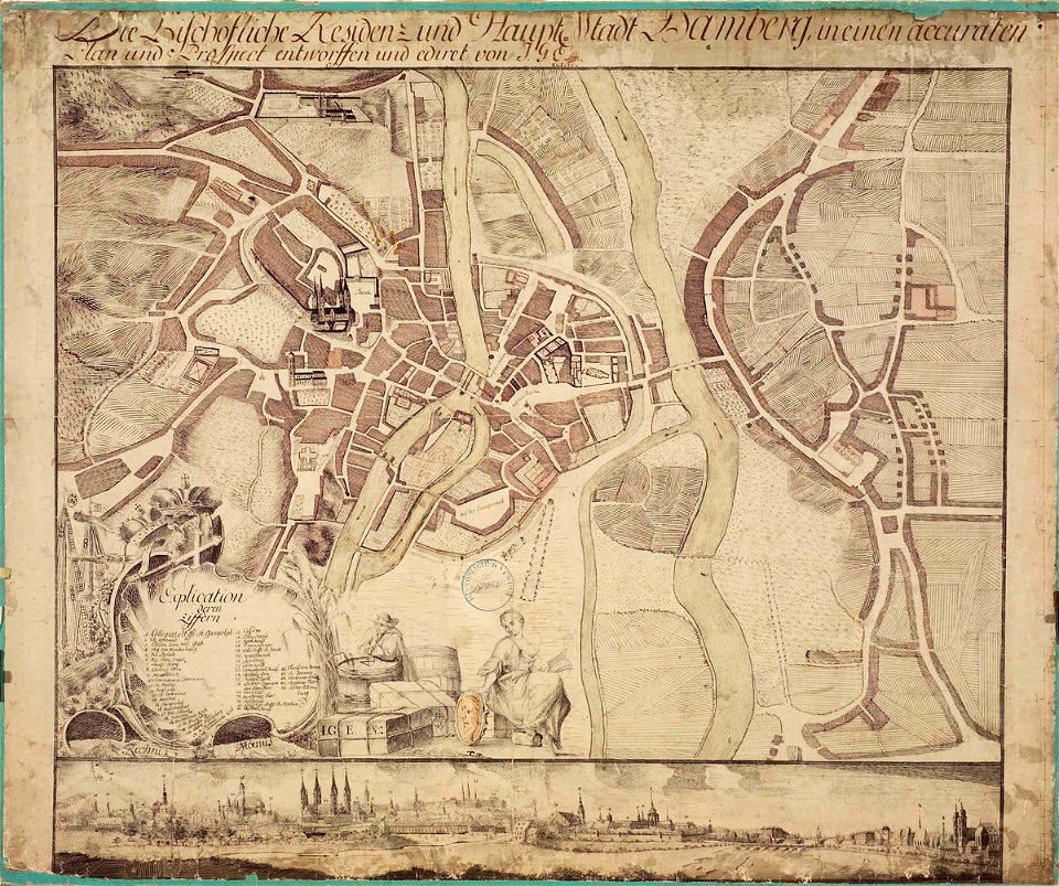
collections of staatsbibliothek bamberg
history of bamberg
old maps of piedmont
history of savoie
charts and maps of the royal museums greenwich
joan martines
bibliothèque municipale de reims
rès. g 153
rhaetiae et valesiae
merian helvetiae
maps of gamla stan
1862 in stockholm
maps by gerardus mercator
eridanus in art
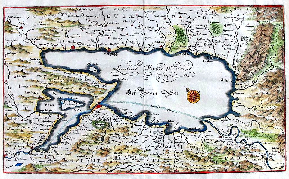
naval war on lake constance
old maps of lake constance
bibliothèque municipale de reims
rès. g 153
bibliothèque municipale de reims
rès. g 153
geographical illustrations by coronelli
engravings of igoumenitsa
images from the new student's reference work
maps of constantinople
description de l'universe
zanzibar in art
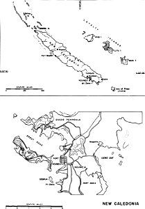
nouméa in world war ii
nouméa
small atlas of the russian empire (1796)
maps of kazakhstan
nouméa in world war ii
nouméa
cosmographia (1600) by sebastian münster
1600 maps of the netherlands
yamaguchi prefectural archives
maps of yamaguchi prefecture
description de l'universe
zanzibar in art
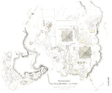
lepsius-projekt - pyramids
plans of giza necropolis
les anciens couvents de lyon
16th-century maps of lyon
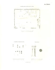
lepsius-projekt - temples
lepsius-projekt - maps
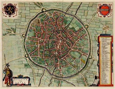
old maps of leuven
atlas van loon
geographical illustrations by coronelli
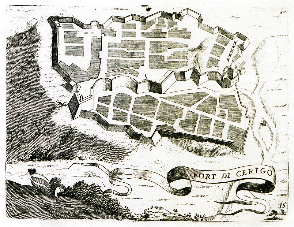
engravings of kythira
geographical illustrations by coronelli
engravings of kythira
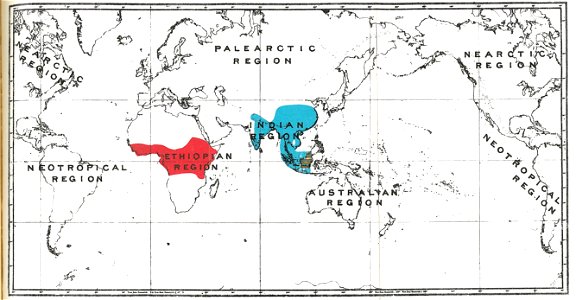
semnopithecus
colobus
history of hanau
maps of hanau
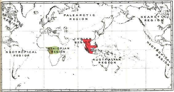
gorilla
pongo
prints from the peace palace library
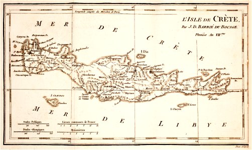
old maps of crete
history of sanssouci
maps of potsdam
historical maps of lüneburg
stadtarchiv lüneburg
bibliothèque municipale de reims
rès. g 153
drawings by samuel de champlain
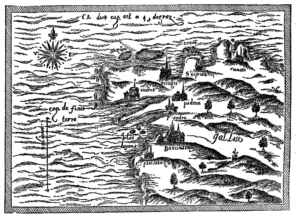
old maps of galicia (spain)
geographical illustrations by coronelli
engravings of kythira
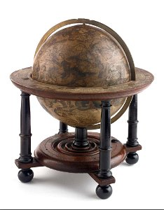
charts and maps of the royal museums greenwich
celestial globe
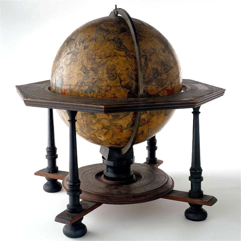
charts and maps of the royal museums greenwich
celestial globe
old maps of bremen (state)
bremen in the 1870s
nicolaes van geelkercken
frederick de wit
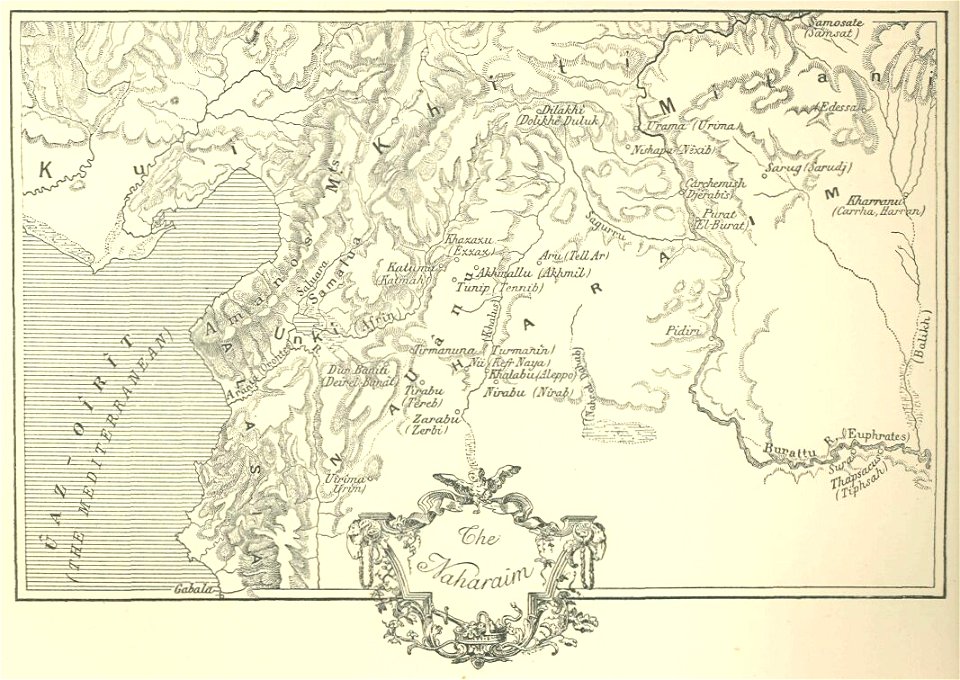
maps of the history of syria
books by gaston maspero
maps of the mexican drug war
drug cartels of mexico
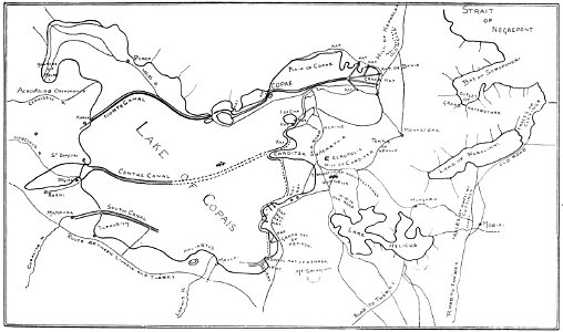
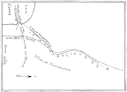
popular science monthly illustrations/volume 48
1896 maps
popular science monthly illustrations/volume 48
1896 maps
la serena
chile
voyage pittoresque de la grèce
naoussa (paros)
paintings in the museum het prinsenhof
old maps of delft
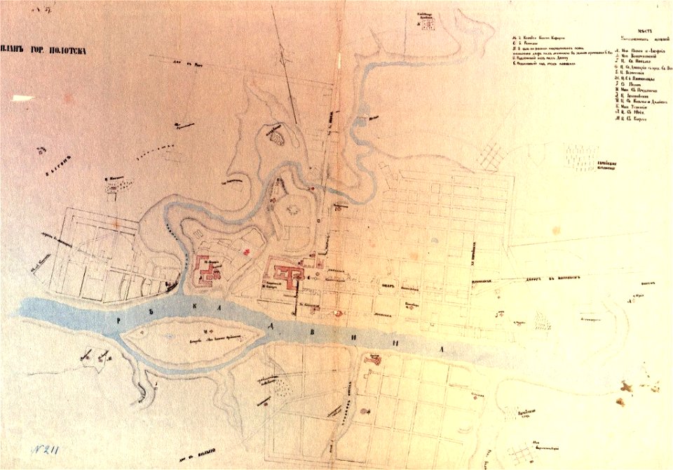
paintings of połacak by dmitry strukov
old maps of polotsk
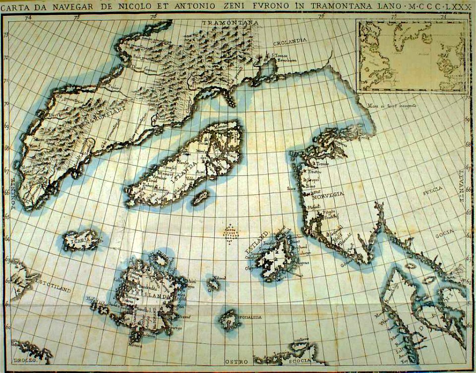
provided by landsbókasafn íslands
maps made in the 19th century
history of weingarten (württemberg)
maps by wenzel hollar
amsterdam in the 1680s
old maps of amsterdam
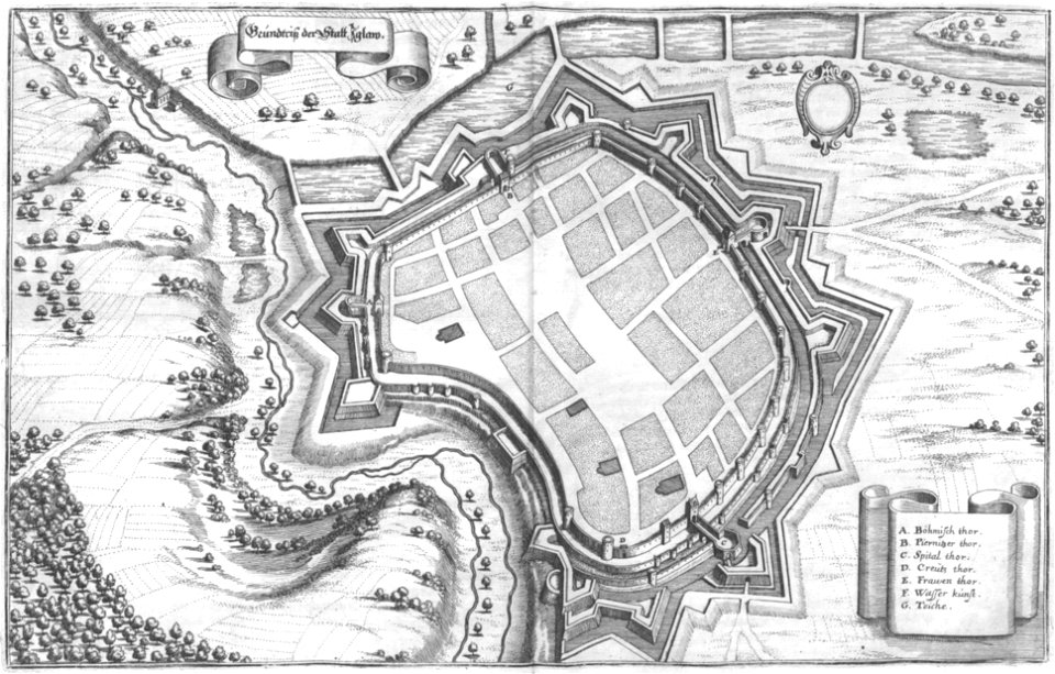
engravings of topographia bohemiae moraviae et silesiae
maps of jihlava
relation of a journey (sandys)
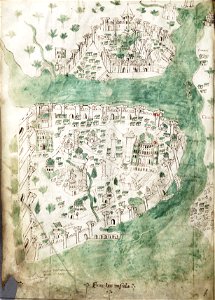
17th-century maps of jerusalem
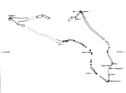
kwajalein atoll during world war ii
maps of kwajalein atoll
9001 - 9100 of 40,209
Next page
/ 403